

この商品を友人に教える:
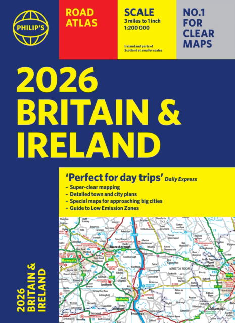
Philip's Handy Road Atlas France, Belgium and The Netherlands: Spiral A5 - Philip's Road Atlases Philip's Maps
価格
¥ 1.658
税抜
遠隔倉庫からの取り寄せ
発送予定日 年12月2日 - 年12月11日
 クリスマスプレゼントは1月31日まで返品可能です


iMusicのウィッシュリストに追加
Philip's Handy Road Atlas France, Belgium and The Netherlands: Spiral A5 - Philip's Road Atlases
Philip's Maps
Philip's Handy Road Atlas of France, Belgium and The Netherlands features new digital cartography from Philip's - voted Britain's clearest and most detailed European mapping in an independent consumer survey. This compact A5 atlas with lie-flat binding is perfect for travelling across France and the surrounding countries.
64 pages
| メディア | 書籍 Spiral Book (糸かがり製本の本) |
| リリース済み | 2025年1月2日 |
| ISBN13 | 9781849077040 |
| 出版社 | Octopus Publishing Group |
| ページ数 | 64 |
| 寸法 | 160 × 210 × 9 mm · 114 g |
すべて表示
Philip's Mapsの他の作品を見る


この商品を買った人はこんな商品も購入
![Cover for George Orwell · Genudgivelser Paperback: 1984 (Paperback Book) [第11 版] (2019)](https://imusic.b-cdn.net/images/item/original/872/9788702291872.jpg?george-orwell-2019-genudgivelser-paperback-1984-paperback-book&class=scaled&v=1575462060)
![Cover for Franz Kafka · The Essential Kafka: The Castle; The Trial; Metamorphosis and Other Stories - Wordsworth Classics (Paperback Book) [UK edition] (2014)](https://imusic.b-cdn.net/images/item/original/260/9781840227260.jpg?franz-kafka-2014-the-essential-kafka-the-castle-the-trial-metamorphosis-and-other-stories-wordsworth-classics-paperback-book&class=scaled&v=1413586223)
![Cover for Rune T. Kidde · Rune T. Kidde: Den store Rune T. Kidde-bog (Bound Book) [第1 版] (2017)](https://imusic.b-cdn.net/images/item/original/616/9788771657616.jpg?rune-t-kidde-2017-rune-t-kidde-den-store-rune-t-kidde-bog-bound-book&class=scaled&v=1516615725)
![Cover for Henrik Marstal · Larmen på Strøget (Sewn Spine Book) [第1 版] (2023)](https://imusic.b-cdn.net/images/item/original/196/9788771849196.jpg?henrik-marstal-2023-larmen-paa-stroeget-sewn-spine-book&class=scaled&v=1672889331)
![Cover for Hanne Overgaard Mogensen og Karen Fog Olwig (red.) · Familie og slægtskab (Sewn Spine Book) [第1 版] (2013)](https://imusic.b-cdn.net/images/item/original/764/9788759316764.jpg?hanne-overgaard-mogensen-og-karen-fog-olwig-red-2013-familie-og-slaegtskab-sewn-spine-book&class=scaled&v=1372716017)
![Cover for Dav Pilkey · Hundemand: Hundemand (8) - Plop 22 (Bound Book) [第1 版] (2021)](https://imusic.b-cdn.net/images/item/original/225/9788711983225.jpg?dav-pilkey-2021-hundemand-hundemand-8-plop-22-bound-book&class=scaled&v=1608555208)
![Cover for Rick Riordan · Olympens helte: Olympens helte (1) - Den fortabte helt (Bound Book) [第2 版] (2019)](https://imusic.b-cdn.net/images/item/original/172/9788711915172.jpg?rick-riordan-2019-olympens-helte-olympens-helte-1-den-fortabte-helt-bound-book&class=scaled&v=1560096818)
![Cover for Atul Gawande · Being Mortal: Illness, Medicine and What Matters in the End (Paperback Book) [Main edition] (2015)](https://imusic.b-cdn.net/images/item/original/828/9781846685828.jpg?atul-gawande-2015-being-mortal-illness-medicine-and-what-matters-in-the-end-paperback-book&class=scaled&v=1447095435)

![Cover for Veena Das · Textures of the Ordinary: Doing Anthropology After Wittgenstein - Thinking from Elsewhere (Paperback Book) [New edition] (2020)](https://imusic.b-cdn.net/images/item/original/697/9780823287697.jpg?veena-das-2020-textures-of-the-ordinary-doing-anthropology-after-wittgenstein-thinking-from-elsewhere-paperback-book&class=scaled&v=1588944946)

Philip's Mapsのすべてを見る ( 例: Spiral Book , Paperback Book , Hardcover Book , Map および Book )